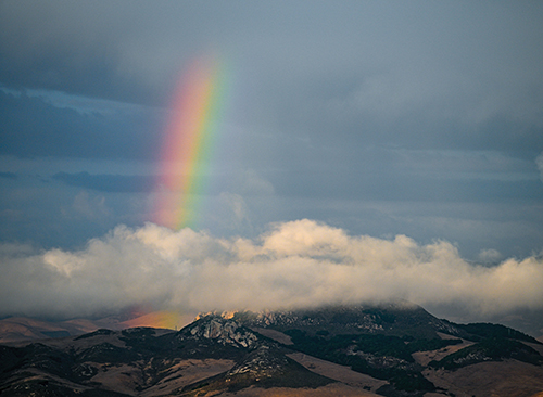

For now the upcoming impacts of El Niño are unknown, but, much like a rainbow, nature is full of surprises. Photo by John Lindsey
By John Lindsey
Record-breaking warm Pacific waters suggest a potentially wet and stormy winter ahead for the Central Coast, but history reminds us that even the strongest El Niño events come with no guarantees.
El Niño isn’t a promise; it’s a possibility.
It’s only October, but a very strong El Niño has already developed across the equatorial Pacific, and some scientists believe it could be the strongest on record!
According to the National Oceanic and Atmospheric Administration’s (NOAA) Climate Prediction Center, there’s now an 83% chance that the current El Niño could surpass the strongest events recorded since 1950, based on the Relative Oceanic Niño Index (RONI) for October through December.
This year’s developing El Niño bears some striking similarities to the powerful 1997-98 event, which produced more than 200% of average seasonal rainfall across portions of the Central Coast.
But will history repeat itself?
Whether it’s El Niño, La Niña, neutral conditions, or what some jokingly call “El Nada,” meteorologists have long monitored seawater temperatures across the equatorial Pacific for clues about the coming winter.
For those of us living along California’s Central Coast, these ocean temperatures provide valuable insights into the likelihood of winter storms, rainfall, and potentially damaging coastal conditions.
The term El Niño dates back centuries to Peruvian fishermen, who noticed unusually warm ocean waters arriving around Christmas. They called it Corriente del Niño, or “current of the Christ Child.”
Today, scientists recognize that this warming is part of a much larger interaction between the ocean and atmosphere known as the El Niño-Southern Oscillation (ENSO).
Under normal conditions, steady easterly trade winds push warm surface water westward across the tropical Pacific toward Indonesia and Australia. This allows colder nutrient-rich water to rise toward the surface along the South American coastline, supporting some of the world’s most productive marine ecosystems.
During El Niño, those trade winds weaken and sometimes reverse, allowing unusually warm water to spread eastward across the Pacific. Warming suppresses the normal upwelling of cold, nutrient-rich water, disrupting marine ecosystems, shifting fish populations, and altering atmospheric circulation patterns around the globe.
Scientists closely monitor a vast region of the tropical Pacific called Niño 3.4, located along the equator between approximately 170°W and 120°W longitude.
Traditionally, an El Niño is considered strong when the three-month average sea surface temperature anomaly in this region reaches at least 1.5°C above normal. The most powerful events, including those in 1982-83, 1997-98, and 2015-16, exceeded 2.0°C and are classified as very strong.
These events provide some fascinating, and sometimes sobering, lessons about California’s winter weather.
During the 1982-83 El Niño, Cal Poly recorded an extraordinary 47.4 inches of rainfall. The 1997-98 event produced 44.0 inches, more than twice the average precipitation for the July 1 through June 30 rainfall season.
However, the very strong 2015-16 El Niño delivered only 19.5 inches at Cal Poly, falling far short of the extraordinary rainfall many had anticipated.
Historically, strong to very strong El Niño events have increased the likelihood of wetter-than-average winters across California, particularly in Southern California. However, the relationship is far from perfect along the Central Coast.
So how can unusually warm seawater thousands of miles away influence our weather?
The answer lies primarily in the atmosphere’s response to the warmer tropical Pacific.
As ocean temperatures rise, evaporation and atmospheric moisture increase, fueling greater thunderstorm activity across portions of the equatorial Pacific. These thunderstorms release enormous amounts of latent heat into the atmosphere, altering large-scale pressure patterns and atmospheric circulation.
These changes can influence the position and strength of the jet streams, particularly the southern branch of the jet stream, often referred to as the subtropical jet.
During strong El Niño winters, this jet stream can become more active and shift the storm track farther south, increasing the likelihood that powerful Pacific storms and atmospheric rivers will reach California.
However, as longtime Central Coast residents know, El Niño doesn’t always follow the script.
I was serving in the United States Navy in the Middle East during the extraordinary 1982-83 El Niño, which produced powerful storms and enormous ocean swells approaching our coastline from the southwest.
Normally, the largest winter swells along the Central Coast originate in the Gulf of Alaska and approach our shoreline from the northwest.
Our coastline’s geography provides a natural degree of protection from these northwesterly swells. San Luis Bay, home to the Harford, Cal Poly, and Avila Beach piers, lies within a partial wave-shadow zone created by Point San Luis and the surrounding coastline.
Similar protection helps shelter the Cayucos and San Simeon piers from certain northwest swell directions.
These naturally protected locations played an important role in where the piers were constructed and have helped them withstand decades of powerful winter storms.
But during strong El Niño events, Pacific storm systems can follow a more southerly track, generating large, long-period west-to-southwesterly swells that enter areas normally sheltered from northwest wave energy.
That’s precisely what happened on March 1, 1983.
An extraordinarily powerful storm generated tremendous waves that destroyed the approximately 2,700-foot-long wooden Unocal Pier at Port San Luis. The pier was subsequently rebuilt using steel and concrete, becoming what we know today as the Cal Poly Pier.
The event demonstrated how a shift in storm tracks and wave direction can dramatically increase the vulnerability of coastal infrastructure.
Fast-forward to the fall of 1997.
I remember a growing sense of anticipation as one of the strongest El Niño events on record developed in the tropical Pacific, even as warm, dry conditions persisted across much of California.
Bright red pelagic red crabs, unusual visitors from warmer southern waters, washed ashore along our beaches. These remarkable creatures, resembling a cross between a small lobster and a crab, were another indication of the changing ocean conditions.
At KSBY-TV, meteorologist Sharon Graves organized an El Niño storm preparedness workshop, bringing together firefighters, law enforcement, emergency planners, and other officials to discuss the possibility of serious winter flooding.
Yet despite all the concern, the early-season rains were relatively modest.
By late January, some people began wondering whether the much-publicized El Niño had been overhyped.
Then February arrived, and everything changed.
A relentless series of powerful Pacific storms battered the Central Coast.
Winds at Diablo Canyon Power Plant gusted to nearly 80 mph. Ocean swells reached heights of approximately 20 feet, and rain fell almost daily. By the end of February, Cal Poly had recorded an astonishing 15 inches of rainfall for the month.
Rivers surged, roads disappeared beneath floodwaters, and widespread flooding disrupted communities throughout the region.
Tragically, the storms also claimed lives.
On February 24, 1998, California Highway Patrol officers Rick Stovall and Britt Irvine were responding to reports of trouble along Highway 166 when their patrol car plunged into the swollen Cuyama River after floodwaters had washed away a section of the roadway.
Both officers lost their lives. Another motorist, Michael Tye, also died after his Chevrolet pickup entered the river.
Their deaths remain a heartbreaking reminder of the tremendous power of floodwaters and the dangers faced by emergency responders during extreme weather events.
Nearly two decades later, the 2015-16 El Niño provided a very different lesson.
Despite being one of the strongest El Niño events ever observed, it failed to deliver the exceptionally wet winter that many had expected along the Central Coast.
These contrasting events illustrate an essential point: El Niño increases the probability of certain weather patterns, but it cannot guarantee how much rain will fall, when storms will arrive, or how severe they will become.
So, what does all this mean for the Central Coast this winter?
Interestingly, we may already be seeing some of the effects of this developing El Niño, not in rainfall, but in unusually elevated coastal water levels.
Recently, observed tides around Morro Bay have frequently been running approximately one foot or more above predicted astronomical tide levels.
Several factors may be contributing to this remarkable situation.
One contributor is a coastally trapped Kelvin wave associated with the very strong El Niño developing in the tropical Pacific.
These waves originate from changes in winds and ocean circulation along the equatorial Pacific. They travel eastward toward the Americas and then propagate poleward along the coastline, temporarily elevating coastal sea levels.
Exceptionally warm seawater along the Central Coast is another contributing factor. As seawater warms, it expands, increasing the volume of the water column and contributing to higher sea levels.
Superimposed on these shorter-term oceanographic processes is the long-term rise in sea level associated with global warming.
Together, these influences can produce coastal water levels considerably higher than astronomical tide predictions would otherwise suggest.
Here’s where it gets concerning.
If these unusually elevated ocean conditions persist into the upcoming king tides around Thanksgiving, Christmas, and again in late January, we could experience some exceptionally high-water levels along the Central Coast.
Consider this hypothetical scenario.
If a predicted high tide approaches 7 feet at Port San Luis and observed water levels remain approximately 1.3 feet above predicted values, the actual still-water level could reach approximately 8.3 feet relative to mean lower low water (MLLW).
At that elevation, portions of the Baywood Park Pier could become submerged, while nearby low-lying coastal areas may experience flooding.
Now imagine those same elevated water levels coinciding with a powerful Pacific winter storm.
Lower atmospheric pressure, storm-driven water-level increases, heavy rainfall runoff, and large, long-period ocean swells could significantly worsen coastal flooding.
Under an unfavorable combination of conditions, still-water elevations could potentially approach or exceed 9 feet. Wave setup and runup could drive water even higher against the shoreline, seawalls, piers, and other coastal structures.
Such a scenario could create serious flooding and damage in vulnerable coastal communities.
To be clear, these are hypothetical scenarios, not forecasts. Ocean conditions can change considerably between now and the winter king tides, and the elevated water levels we’re observing today may not persist.
Nevertheless, they illustrate how a powerful El Niño, exceptionally warm ocean waters, long-term sea-level rise, and energetic Pacific storms can combine to amplify coastal flooding hazards.
And that may be one of the most important lessons from the great El Niño winters of the past.
It’s not just about how much rain falls. It’s also about the timing of the storms, the direction and energy of the ocean swells, the height of the tides, and how these different forces interact.
As for this winter, the odds appear to favor wetter-than-normal conditions across portions of California, including the Central Coast.
But as the winter of 2015-16 so clearly demonstrate, there are no guarantees.
The Pacific Ocean is sending some extraordinary signals this autumn. Whether those signals translate into a winter of record-breaking rainfall, powerful storms, coastal flooding, or something far less dramatic remains to be seen.
For now, we’ll continue watching the ocean, monitoring the atmosphere, and remembering that even the strongest El Niño doesn’t write the winter forecast in advance. The ocean provides the clues. The atmosphere determines how the story unfolds.